
Six circular walks near Reigate of 3 to 6 miles, with start postcodes, parking and stiles, plus Box Hill, Headley Heath and Earlswood. Checked October 2026.
Most walks near Reigate start in one of three places. Reigate Hill, for the National Trust’s 3.3-mile circuit along the North Downs. Reigate Heath, for the county council’s 4.5-mile loop past the windmill church. Banstead Woods, with its free car park, Narnia trail and two council routes. Box Hill and Headley Heath are a short drive west. Every entry was checked against the managing body’s own pages on 26 October 2026.
We have not walked these routes for this guide, and nothing here is a review. Each entry sets out what the landowner or council publishes: the distance and time, where it starts, the car park and what it costs, stiles and gates, toilets and refreshments, and the rules for dogs. Where a route has a map and directions, we link to it.
Reigate and Gatton
Reigate Hill walk, National Trust
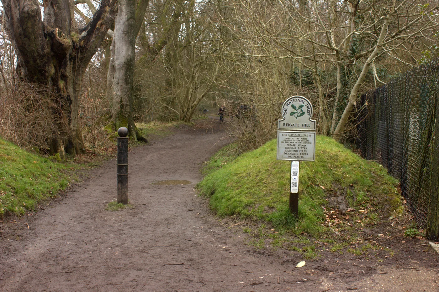
The National Trust describes this stretch of the North Downs as “good walking country with flower-sprinkled grasslands and quiet shady woods”, with “sweeping views across the Weald” from the escarpment. Its Reigate Hill walk is a 3.3-mile (5.3km) circuit of about two hours, according to the council’s walking page, which grades it moderate and says it is not suitable for wheelchairs or pushchairs because of steps and a steep descent on a chalk path. It starts at the Margery Wood car park (KT20 7BD), where non-members pay £2 for an hour, £4 for two, £6 for four or £9 for the day; Trust members park free. The Trust warns there is no phone signal, so set up the JustPark app (location 80624) before you go. The Wray Lane car park (RH2 0HX) has a servery open 10am to 4pm and an accessible toilet, both run by others, not the Trust. From there the path along the top of Fort Lane to the Victorian Reigate Fort is, the Trust says, “smooth and fairly level”. Buses 420 and 460 stop on Reigate Hill, and Reigate station is about a mile below. Dogs are welcome on a short lead near grazing livestock. The hill is a Site of Special Scientific Interest. Map and directions (National Trust).
Reigate Heath: the mills and pillboxes walk
Surrey County Council’s Reigate mills and pillboxes walk is a 4.5-mile (7km) circular route of about two hours across Reigate Heath and down towards the River Mole. It passes the heath’s windmill, built in 1765 on Galley Hill and a chapel since 1880, the converted Wonham Mill, and Second World War pillboxes, and follows parts of the Greensand Way. The council grades it moderate, with several kissing gates and stiles, and warns parts can be muddy. It starts at the Reigate Heath bus stop where Flanchford Road meets the A25 (bus 32). There are car parks either side of Flanchford Road; the borough council gives the Reigate Heath car park as RH2 8QR. The borough council says the heath is both an SSSI and a Local Nature Reserve, with Bronze Age burial mounds protected as Scheduled Ancient Monuments. The Skimmington Castle and the Black Horse are near the start.
Priory Park and the Town History Treasure Trail
For a shorter walk in town, Priory Park on Bell Street (RH2 7RL) has lakes, a café, toilets and parking around the Grade I listed Reigate Priory, according to the council’s park page. The pavilion café is run by Creamy and Bites. Dogs must be on a lead in the formal areas, including the sunken garden, around the café and by the tennis courts. The council’s free Town History Treasure Trail, published in 2013 for the 150th anniversary of the borough’s Royal Charter, starts in the park and ends at Reigate Castle (RH2 0AP). It takes about an hour. The council says the paths are fairly level until the last part, a cobbled alley and the Donkey Steps, which is not suitable for wheelchairs or pushchairs. The Reigate and Redhill Society also publishes an eight-page Reigate Town Trail through the oldest streets.
Gatton Park open days
Gatton Park is the Capability Brown parkland and Edwardian gardens below Reigate Hill, run by the Gatton Trust (RH2 0TW). It is open to the public on the first Sunday of each month from February to December and is not open outside paid open days and organised activities. The next is the Autumn Open Day and Trail Walk on Sunday 1 November, 12pm to 5pm: the trust says the whole 250 acres will be open, with a marked 3km trail through the park, and calls it “perfect for dog walkers and families”. Tickets are £7 for adults booked online or £9 on the door, and children go free. The Gatton Hall tea room opens on the day. The National Trust, which owns land at Gatton, says a map of its “Discover Gatton” circular walk is on the leaflet board at the Wray Lane servery.
Redhill
Earlswood Common and the lakes
Earlswood Common, south of Redhill, covers about 100 hectares (247 acres) with two large lakes, ponds, wetland and grassland, according to the council. It is a Local Nature Reserve. The council’s leaflet says the Lower Lake is mentioned as early as 1363, and the Upper Lake was dug some time after 1884. Roe deer, bats and the nationally rare chamomile are recorded here. Dogs must be on a lead in the car park and on the paths around the lakes, and can run free on the rest of the common under a council order. The common sits between Pendleton Road, Woodhatch Road (A2044) and the A23 Horley Road; from Earlswood station walk down Earlswood Road to its edge. The paths around the lakes are flat, and the council publishes a leaflet and wildlife spotter sheet.
Banstead, Tadworth and the Downs
Banstead Woods: the nature trail, the Narnia trail and the countryside circular
Banstead Woods and Chipstead Downs is a council Local Nature Reserve and SSSI, entered from the free Holly Lane car park (CR5 3NR), which has a 1.9 metre height barrier. Chipstead station is about 500 metres away. The council says the woods were a medieval deer park, enclosed in 1439. It publishes two routes from the car park. The Banstead Wood nature trail is a 3-mile (5km) circle of about two hours, graded fairly easy, with slopes, kissing gates and paths that can be muddy in winter. The Banstead countryside circular is 5 miles (8km) and about three hours, graded challenging, with steps and steep slopes, through the bluebell woods of Chiphouse Woods and the orchid grassland of Park Downs. There are no facilities on the route; the council points to the shops in Chipstead and the Rambler’s Rest on Outwood Lane. Children can follow the Narnia trail through a wardrobe door hung with coats to a carved Aslan.
Banstead Heath
Banstead Heath is the largest of the four Banstead Commons at 760 acres, managed by the Banstead Commons Conservators under an 1893 Act of Parliament that gives them a duty to keep the commons open and free to the public. The Conservators describe a mix of heath, acid grassland meadows and woodland of oak and birch, with three kinds of heather, and say it is “very popular with all users, particularly walkers, cyclists and horse riders”. There are more than eight miles of bridle paths and permissive rides, so expect to share some paths with horses. The Conservators publish a site map and an interactive guide to all four commons, including Banstead Downs, Park Downs and Burgh Heath.
Tadworth: the horses and downs walk
Surrey County Council’s Tadworth horses and downs walk is a 6-mile (9.5km) circle of about three hours from Tadworth station, through the racing country around Epsom Downs and past Langley Vale Wood. The Woodland Trust has planted 180,000 trees there since 2014, making it the country’s largest First World War centenary wood, the county says. It is graded challenging, with six stiles, several staggered barriers and a kissing gate, and some fields may hold horses. The station has no car park; the county says there is some roadside parking after 9.30am. Buses 420 and 460 serve the station. The county lists a pub in Walton on the Hill, and a pub and village stores in Headley at stage 4 of the walk.
Box Hill, National Trust
Box Hill (KT20 7LB), just over the borough boundary on the North Downs, has its postal address in Tadworth. The Trust says “there are lots of walks over the hill, which you can download, or collect on site”. For children it has a natural play trail, which it describes as “a fun, easy 2-mile (3km) woodland walk” on a level, all-weather path with balancing and climbing challenges. Toilets are next to the café by the main car park and open when the café and servery do. Parking is £2 for an hour up to £9 for the day for non-members, free for members, paid through JustPark; the Trust warns there is no signal. It lends a Mountain Trike all-terrain wheelchair free of charge, booked by email to boxhill@nationaltrust.org.uk, and says some paths through the woods and to the views are accessible. Dogs are welcome, on leads where livestock graze. Box Hill (National Trust).
Headley Heath, National Trust
Headley Heath on Headley Common Road (KT18 6NN) is a mix of “open heath, chalk downland slopes and mixed woodland” with a wide network of tracks, according to the National Trust, and is an SSSI. Its family trail, the Lizard trail, starts at the main car park. The Trust says there are no toilets on site; a mobile van (not run by the Trust) sells drinks, ice creams and snacks in the main car park from 9am to 4.30pm daily. Parking at the main and Brimmer car parks is £2 for an hour up to £9 for the day for non-members, free for members, via JustPark. On 26 October the Trust’s notice said its cattle were grazing area C and asked walkers to keep dogs on a short lead around them. Headley Heath (National Trust).
Horley
East Horley circular walk
The county’s East Horley circular is a flat 6-mile (9.5km) walk of about three hours from the edge of town into farmland, streams and woods. It passes Second World War pillboxes, a 16th-century tanning pond in Scotchman’s Copse that is listed as an Ancient Monument, and the site of Thunderfield Castle. It is graded moderate and is not suitable for wheelchairs or buggies, with steps, gates and stiles. There are no toilets on the route. It starts and ends at The Farmhouse on Ladbroke Road, Langshott (RH6 8PB), which describes itself as a 17th-century Grade II listed pub with a garden, dog-friendly spaces and a children’s menu. There is roadside parking outside the pub and a small lay-by beyond it. Horley station is under a mile away.
Riverside Garden Park and Church Meadows
Horley’s two riverside open spaces are on the Horley Town Council’s parks pages. Riverside Garden Park (Riverside, RH6 7LN) is woodland and grassy glades, partly bounded by the Gatwick Stream, with a man-made lake, a car park and a tarmac path. The town council calls it “a favourite local dog-walking venue”; anglers fish the stream and the lake. Church Meadows (Brighton Road, RH6 7ER) lies south-west of St Bartholomew’s Church, with the River Mole on its western edge forming the boundary with Mole Valley. The council says it has a wildflower meadow in summer. Both are part of the Horley Green Chain of floodplain open spaces. Ye Olde Six Bells is on Church Road next to the church.
How we chose
This is a list of the walks people look for near Reigate, chosen on what can be checked, not on taste. Every route here is published by the body that manages the land or the paths: the National Trust, Reigate and Banstead Borough Council, Surrey County Council, the Gatton Trust, the Banstead Commons Conservators and Horley Town Council. Distances, times and gradings are theirs, not ours, and so are the car park prices, which we took from the Trust’s own visitor information on 26 October 2026. Paths on the Downs and the Weald clay get muddy from now until spring, so check the route map before you set out and follow the Countryside Code.
For more ideas, see things to do in Reigate, what’s on in Reigate this month, Gatton Park this winter and our guides to Reigate pubs, Sunday roast and Reigate cafes. Local businesses are in our Reigate business directory.
Run a place that should be here, or spot something that has changed? Email newsdesk@reigatenews.co.uk.
Frequently asked questions
What is the best circular walk from Reigate?
The two most used are the National Trust’s Reigate Hill walk, 3.3 miles from the Margery Wood car park with views over the Weald, and Surrey County Council’s Reigate mills and pillboxes walk, 4.5 miles from Reigate Heath past the 1765 windmill church. Both take about two hours and both have stiles, steps or gates.
Where can I park for free to walk near Reigate?
Holly Lane car park at Banstead Woods (CR5 3NR) is free, with a 1.9 metre height barrier, and is the start of two council walks. The National Trust car parks at Reigate Hill, Box Hill and Headley Heath charge non-members £2 for an hour up to £9 for the day; Trust members park free.
Are there easy, pushchair-friendly walks near Reigate?
The National Trust says the path from the top of Fort Lane to Reigate Fort is smooth and fairly level, and Box Hill’s 2-mile natural play trail runs on a level, all-weather path. The council and county circular routes all have stiles, kissing gates or steps.
Have your say